November 15, 2017 Meeting Summary
-- see also the October 25, 2017 meeting summary
Norah Robinson, King County Parks – Marymoor Park lead; Greg Helland, FOMP President; Michael Hobbs, FOMP Secretary, Webmaster; Shane Berry, AEG Live; Steve Guty, MAR/C; Brandy Rinck, King County Parks Archeologist; Laura Hall, Marymoor Community Gardener's Association, FOMP Board;
2) Cultural Resources Maintenance and Stewardship Protocols – Brandy Rinck
Brandy has a degree in Geoarcheology from Boston University. Understands how to assess soil stratigraphy, etc., so she can understand where and how deep to search for artifacts based on what is being looked for. She has worked for a private firm, including when working locally on the Bear Creek realignment project.
With KC Parks, Brandy has been focusing on maintenance projects, rather than on Capital projects. This has involved tree planting and fence posts, etc., with much of her time spent at Marymoor. The headwaters of the Sammamish Slough have some very old artifacts, dating back as far as 12000 years ago! This area was a gathering point for many tribes, which is why notice must be given to the tribes who regularly visited this area: Muckleshoot Indian Tribe, Snoqualmie Tribe, Stillaguamish Tribe of Indians, Tulalip Tribes, Puyallup Tribe of Indians, Suquamish Tribe, and Duwamish Tribe (through a community group, since they do not have Federal status), as part of any permitting processes.
There have been 20 substantive cultural resources assessments at Marymoor, dating back to 1964. Some parts of the park are especially sensitive, with many artifacts. Indeed, some resources are so close to the surface that even mole hills contain artifacts. The identified cultural sites include13 pre-contact sites (prior to 1850), one historical site, and a King County Landmark District. More sites are immediately adjacent to the Park (i.e. the East Lake Sammamish Trail runs on the right-of-way of an old railroad, and is thus a historic site). On most county land, any digging or soil disturbance within 0.15 miles of an identified site is subject to increased scrutiny. Typically, this would consist of applying for a permit (even the application requires an archeologist). This is a lengthy process. Marymoor Park, however, has special status due to the large number of sites already found. At Marymoor, any disturbance not in an area already found not to contain artifacts is immediately under the highest level of scrutiny.
Brandy has done a lot of work recently, which has found that many of the areas, where fencing and replanting work has been stalled within the Dog Area and the Audubon Bird Loop, did not contain artifacts.
General rules for Marymoor: If you want to do something that would disturb the soil (even a little bit), submit a proposal to Norah with an aerial photo with very specific disturbance sites marked, and with accurate disturbance depths. This will go to Brandy, who will either come back immediately with clearance because the sites have been previously surveyed, or else things proceed to Tier 2 or 3, which can take a while. Brandy will submit the request to the Historic Preservation Program (HPP) when necessary, and the determination will be made about how much surveying needs to be done. If the diggings would be within known archeological sites, things get much slower and more expensive. But often Brandy will be able to work closely with the applicants, including being on-site during work. This may require a project to be done in phases; with SODA, they worked out a process where during one work party, old posts would be pulled. At a later work party, new posts would be installed. In between the work parties, Brandy would work alongside a small team enlarging the post holes to accommodate the new posts.
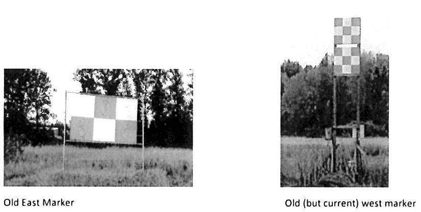
3) R/C Field Markers & Banners
Steve gave a run-down of some of the current activities at the MAR/C model airplane field. They are replacing the old field boundary markers:
with new ones:
The new markers are scaled to show the dimensions of a large (80" wingspan) gas model at the outer edges of the black border, and the wingspan of a large (~70" wingspan) glow-powered model as the inner dimensions of the black border. By matching or comparing their own aircraft's apparent size to the diagram, it is hoped pilots will be better able to judge when their aircraft are at the flying zone borders.
The East marker has already been replaced; the west marker will require a new mounting structure, and that is in the works. MAR/C is very concerned with being good neighbors to both the Audubon Bird Loop in the East Meadow, and the condos to the west and northwest of their field. They are very aware that bad behavior could be detrimental to their group, so they are being proactive in trying to avoid conflicts. They are improving signage and training, and will be making sure aircraft do not exceed the sound limits.

g) New parking fee collection machines: Norah floated the idea of switching to something like the Orca Card to replace the long-term parking passes, and to use license plate recognition to check for day use payment (i.e. you put in your dollar and enter the license number, and enforcement checks license plates to see of you’ve paid). The east end booth would also use the license recognition, with an actual gate.
4) CIP/Project/Facilities Updates
a) Community Gardens – water is off, as the season is officially over. Still no final number of pounds of veggies to Hopelink. Apiary is moving to the SE corner of the Pea Patch.
b) Lake Hills/NW Lake Sammamish Sewer Upgrade Project – drop-in public information sessions were held November 16th. See http://www.kingcounty.gov/depts/dnrp/wtd/capital-projects/active/lake-hills-nw-lake-sammamish.aspx for information about this project.
c) Sound Transit - Downtown Redmond Link Extension (DRLE) – There was an Open House on November 16th. See https://www.soundtransit.org/Projects-and-Plans/Find-a-Project/downtown-redmond-link-extension for information about this project.
d) Cut-through traffic / New parking fee collection machines – Parks will be installing a second generation of parking machines to replace the old ones which are no longer supported by the manufacturers. The new machines will require you to put in your dollar AND enter the license number of the car. This will allow license plate based enforcement.
Norah floated the idea of switching to something like the Orca Card to replace the long-term parking passes. These cards would be tied to a particular license plate, and would need to be tapped against a ticket machine each visit. This would enable complete license-based parking enforcement.
Such technology may also be useful in addressing cut-through traffic. Perhaps an automated east-entrance booth, with a gates and license recognition, could mean only those who had paid for that day could exit to the east. And possibly people entering from the east would be required to buy or tap to enter.
5) Other
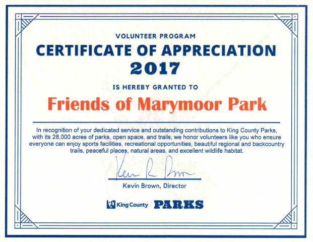
The Friends of Marymoor Park was honored with a Certificate of Appreciation by King County Parks recently:
There is no December meeting of FOMP. Our first meeting for 2018 will be on Wednesday, January 24th, 2018 at 7:00 p.m. in the Art Barn
These notes do not constitute an official record of the meeting. They may have inaccuracies and omissions. If anyone has any complaints about the content of these notes, they should direct them to Michael Hobbs at fomp@marymoor.org, and he will endeavor to correct them.